
Bahamas News
New ‘ReefShape’ Photogrammetry System Puts Bahamian Coral Reefs on the Map — Literally


Open-source workflow from Perry Institute for Marine Science researchers enables automated data processing, arming reef managers worldwide with rapid, easy-to-use solutions for large area imaging.
Media Contact:
Written by Lily Haines | PIMS | WhatsApp +1 (613) 791-6045 | lhaines@perryinstitute.org
June 17, 2025—NASSAU | Coral reefs cover less than one percent of the ocean floor yet anchor a quarter of all marine life. Protecting them has been the Perry Institute for Marine Science’s (PIMS) mission for more than 50 years—work that spans cutting-edge coral restoration, fisheries research and the Caribbean-wide Reef Rescue Network of coral nurseries.
Now PIMS scientists, working with Arizona State University, have unveiled ReefShape, an automated photogrammetry pipeline that converts thousands of underwater photographs into millimeter-accurate, 3-D and 2-D reef maps in hours instead of days. Their method, published this week in the Journal of Visualized Experiments (JoVE), gives managers from Abaco to Zanzibar a practical and streamlined way to track bleaching, storm damage and restoration success at the millimeter scale.
“We needed a method that’s easy to teach, automatic, and lets us focus on actually saving coral reefs rather than just making maps of them,” said lead author Will Greene, photogrammetry specialist and research scientist at PIMS.
The reef-mapping bottleneck
Photogrammetry—the digital alchemy that converts overlapping photos into lifelike 3D models—has transformed archaeology, forestry and even Hollywood. Yet under water it has remained a specialist’s sport: equipment can top US $20,000, and the software pipeline still relies on hours of manual clicks. In the meantime reefs around the world bleach, crumble or succumb to disease weeks before new data reach managers’ desks.
Headquartered in the United States, PIMS is a non-profit research organisation dedicated to ocean conservation and community engagement around the world. Through its flagship Reef Rescue Network—the region’s largest coalition of coral nurseries—PIMS has already planted tens of thousands of elkhorn, staghorn and fused staghorn corals throughout the Caribbean, restored critical reef habitat, and trained hundreds of local divers, students and tourism operators in reef-monitoring techniques. PIMS also leads research on sustainable fisheries, mangrove and seagrass restoration, and partners with governments to translate science into policy that safeguards coastal livelihoods.
Three simple upgrades
Turning big-picture conservation goals into on-the-ground action—and doing it fast enough to matter—meant re-engineering reef mapping for the realities of a dive boat. Instead of inventing another costly gadget, Greene’s team asked what the absolute essentials were and how to make each one fool-proof. The answer distilled into three simple upgrades that, together, turn a labour-intensive workflow into a backpack-friendly kit:
- Permanent corner markers. Four dinner-plate-sized markers drilled into the reef plot corners act as digital anchor points. Software recognises them automatically, snapping every future survey into perfect alignment.
- Phone-based GPS logging. A free Survey123 form guides divers to collect surface positions and depth readings of the markers, then formats the data for the processing script—no spreadsheets, transcribing coordinates, or typos.
A fully scripted pipeline. Custom Python code drives Agisoft Metashape processing through a graphic interface, whizzing through image alignment, mesh generation, orthomosaic building, data export and even structural-complexity metrics with no keyboard input beyond run.
From dive to desktop in 1 hour 58 minutes
Using the fully automated ReefShape script, a 200 square meter, 1,300-image reef plot can be processed in under 2 hours on a modern laptop—roughly 400 percent faster than the same dataset handled with earlier, semi-manual workflows. Even on 2018-era hardware, the scripted pipeline still shaved hours off turnaround because most of the speed-up comes from automation and careful workflow optimization, not brute processor power.
Stress-tested during a record heatwave ReefShape’s coming-of-age moment arrived during the record marine heatwave that washed over The Bahamas in August 2023. Having surveyed Simms Point Reef seven months earlier, the team returned with a camera and retraced their path above the permanent markers. Hours later, side-by-side mosaics revealed that over 90 percent of corals in several species had bleached completely, while a handful of colonies clung to colour.
“That immediate feedback lets us prioritise restoration sites and share data with partners before the next storm hits,” says Dr. Craig Dahlgren, PIMS executive director and co-author on the new paper. “It’s like switching from film to livestream.”
Democratizing a critical tool
Everything needed to utilize the workflow—recommended camera system, field equipment, a suitable computer and software—comes in around US $5,000 ($8,000 without educational software discounts). The scripts and step-by-step manual live for free on GitHub, and the authors encourage anyone mapping coral, seagrass, mangroves or shipwrecks to fork and improve the code.
The design is deliberately tolerant: while the protocol gives specific instructions for researchers wanting a cookbook-style approach, it works for plots from 25 m² to > 1,000 m², depths down to 30 m, any camera system and swim pattern with sufficient overlap, and on any recent computer. The ReefShape software includes adjustable controls to suit different data collection strategies and researcher needs while remaining streamlined and easy to use, automatically exporting data pre-formatted for analysis in free software packages like QGIS or TagLab.
Why it matters
Coral reefs occupy less than one per cent of the ocean floor yet shelter a quarter of marine speciesand buffer tropical coastlines from storms.

With mass-bleaching events now recurring every few years, conservationists need diagnostics that are fast, cheap and repeatable—tools that turn snapshots into time-lapse. ReefShape, its creators argue, is a step toward that future. “Our goal wasn’t another complex method,” says Greene, now completing a PhD at Arizona State University on GIS-driven 3-D reef mapping. “It was to hand every reef manager a simple, comprehensive monitoring tool, then get out of the way so they can use it.”
ReefShape was developed by Will Greene, Sam Marshall, Dr. Jiwei Li and Dr. Craig Dahlgren, with funding from the Disney Conservation Fund and the U.S. National Science Foundation. Fieldwork was conducted under permits from the Bahamas Department of Environmental Planning & Protection. Full documentation and code: https://github.com/Perry-Institute/ReefShape.
PHOTO CAPTION:
1st insert: Time-series aligned imagery of Simm’s Point Reef in New Providence before (left) and during (right) the 2023 mass bleaching event. The data were processed automatically in ReefShape, allowing researchers to rapidly analyze the extent and severity of the bleaching event (bottom panel), uncovering different patterns among the various coral species present.
3rd insert: The ReefShape field kit—ready for a single-tank survey. (A) Mirrorless camera with wide-angle rectilinear lens; (B) matching underwater housing and dome port; (C) Bluetooth-enabled “kickboard” GPS for surface positioning; (D) reusable coded corner markers that lock each plot to precise coordinates; and (E) coded scale bars that set the model’s exact dimensions.
Fly-through of a ReefShape 3D model of a coral reef: a centimetre-scale, colour-true reconstruction that lets scientists measure coral growth, bleaching and erosion without getting wet.




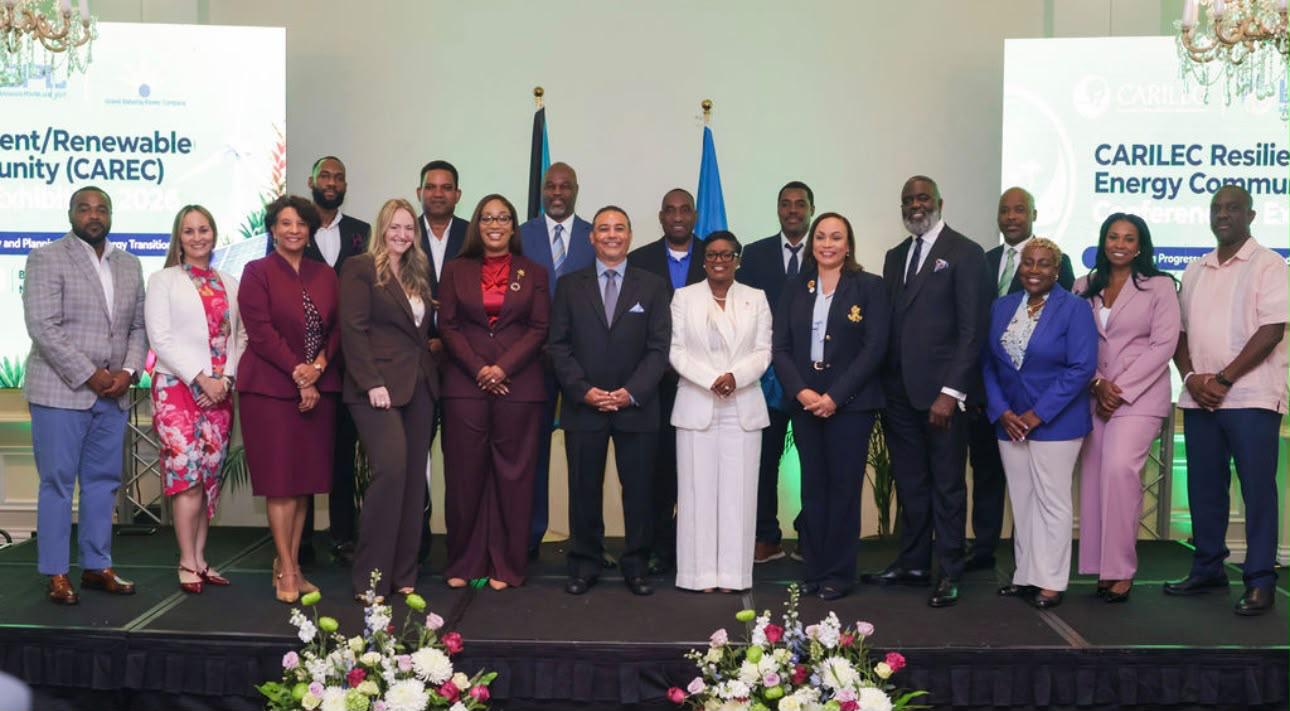
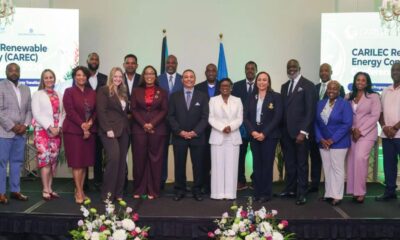
NASSAU, The Bahamas – The Bahamas’ Minister of Energy, Utilities and Aviation, The Honourable JoBeth Coleby-Davis, delivered an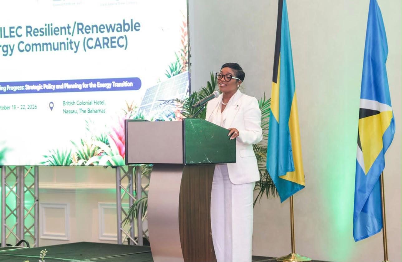 electrifying address during the opening ceremony of the 2026 CARILEC Resilient/Renewable Energy Community (CAREC) Conference and Exhibition, being held October 18–22, 2026, at the British Colonial Hotel in Nassau, The Bahamas.
Under the theme “Empowering Progress: Strategic Policy and Planning for the Energy Transition,” the event draws more than 200 industry leaders, policymakers, regulators, and energy professionals committed to advancing practical strategies for sustainable and reliable Caribbean power systems through renewable energy and emerging technologies.
During her address, titled “The New Energy Era: Transforming Policy into Progress,” Minister Coleby-Davis reminded attendees that The Bahamas’ national motto, “Forward, Upward, Onward, Together,” aptly describes what the region’s energy transition demands.
“Empowering Progress speaks directly to our national motto. Not waiting for progress, but creating the conditions that allow progress to happen. Meaningful progress, however, does not occur by accident. It requires vision, sound policy, strategic planning, strong institutions, and the determination to turn decisions into results,” said Minister Coleby-Davis.
Participants acknowledged that small island developing states share similar pressures, compounded by geographical challenges, small electricity markets, ageing infrastructure, geopolitical influences, and the growing threat of severe weather.
Tasked with ushering in a new energy era across the islands while addressing the challenges posed by The Bahamas’ unique archipelagic composition, Minister Coleby-Davis said, “Every island needs a different answer, but the same logic. As an archipelagic nation, we must provide electricity across many islands, each with its own demand and infrastructure needs. Our strategy, therefore, must be national in direction, but responsive to individual communities.”
Restating her Ministry’s three core messages—that energy is an economic and security priority, technology must be viewed as a tool to support strong institutional leadership, and natural gas should be considered a bridge, not a destination—Minister Coleby-Davis reiterated that “progress must now be reflected in functioning infrastructure, effective institutions, and better electricity services: from policy commitments to coordinated implementation, and from fragmented investment decisions to long-term planning.”
Organised by CARILEC and co-hosted by Bahamas Power and Light (BPL) and Grand Bahama Power Company (GBPC), the annual Conference and Exhibition brings together the Caribbean energy community to advance practical solutions to the region’s most pressing energy challenges and accelerate progress towards more resilient, reliable, and sustainable power systems.
Bahamas News
Rosewood Exuma: A precedent-setting case for environmental law and future development in The Bahamas
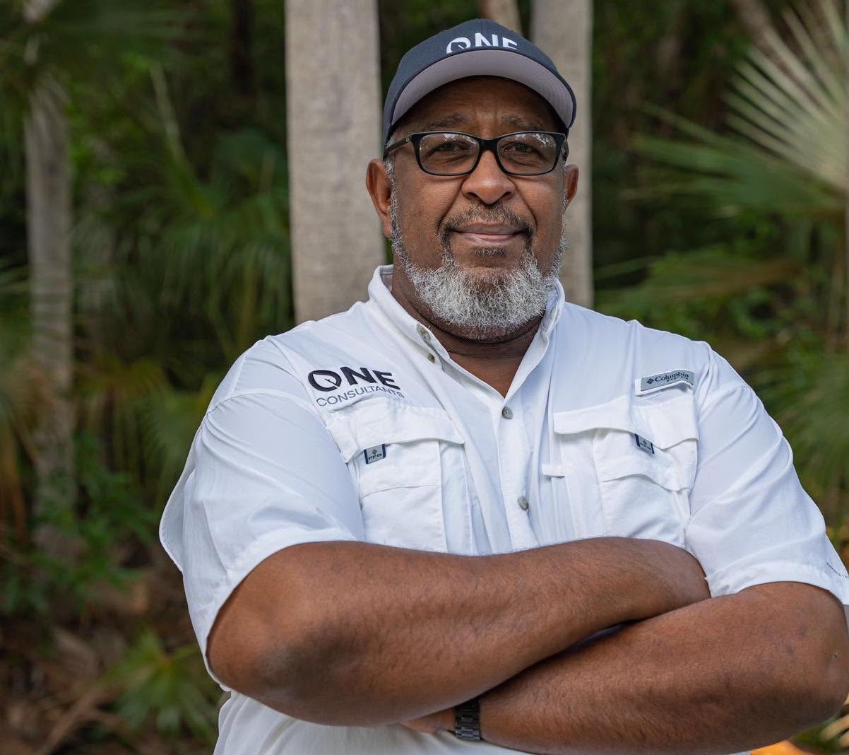
By Eric Carey, ONE Consultants, former Executive Director of the Bahamas National Trust.
We are facing an extraordinarily important moment in judicial history in The Bahamas as we await a decision on the trial of allegations in the Yntegra group’s Rosewood Exuma project.
As former Minister of the Environment, Romauld Ferreira, put it in the Supreme Court last week: “A lot is at stake…a great deal of what will be considered in this case sets the stage for what’s to come for future development in the country.”
In the trial of the judicial review of government approvals given to Yntegra for their Rosewood Exuma resort this week, we’ve heard technical arguments about failure to make key environmental documents like Yntegra’s Environmental Impact Assessment and Environmental Management Plan available to the public, failure of key documents to assess some of the most controversial aspects of the project, an unlawful consultation process, and a failure to conduct further consultation following major changes to the development.
Lawyers for Turtlegrass described how there was a “salami slicing” of the project into chunks as a way to circumvent the approvals process and disguise its full impact from public scrutiny. Only certain portions came before the public and key stakeholders like Turtlegrass and Over Yonder Cay for scrutiny, while some of the most controversial aspects did not. This is particularly problematic given what is at stake – the dredging of a beautiful Exuma bay, the North Bay, to transform it into an industrial shipping channel, complete with an enormous seawall, dock, back-of-house facilities and other industrial infrastructure.
It is unfortunate that it has had to come to this – an expensive judicial review process that calls out the government for falling down on its duties to protect the environment and follow the law – but it is important and the broader implications should not be overlooked. When Justice Leif Farquharson rules on this case, he’ll set a precedent that could echo in The Bahamas for years to come, one that answers the question: are the 2019 environmental laws that Ferreira took to parliament after many years of advocacy by environmentalists toothless tigers that are just for decoration – or are they capable of protecting the environment that we all depend on and the rights of those affected by projects to have a genuine say in them?
What is curious is that at the same time as these points are being raised in court as part of the judicial review, we are seeing personal attacks about Bob Coughlin – the person spearheading this legal action and test of environmental laws – by online trolls. Coughlin, an Exuma resident for almost a decade, has long been established as an environmental advocate and a passionate philanthropist – one who has donated almost $4 million to causes in The Bahamas since 2018, including millions to the organisation I once led, the Bahamas National Trust.
For reasons one can only speculate about, these trolls have been trying to make out all sorts of absurd things: that his legal action in support of environmental protection is a petty dispute born out of fears of competition. That Coughlin no longer even wants to pursue his eco-tourism project, when the reality is that he was forced to put it on hold because of the destructive environmental plans that are in dispute. That he is the only one who has an issue with this Rosewood Exuma resort, when in fact, neighbouring resort, Over Yonder Cay – one of the top rated resorts in the Caribbean – as well as the Save Exuma Alliance – consisting of most of the local islands and businesses in the Exuma area, and thousands of petition signers have expressed their concern with the project – over 9,000 to date. Most ironically, they claim, wrongly, that Coughlin received crown land for personal use, when in fact it is Yntegra who received crown land while having no development track record, when Coughlin instead bought his lease on Sampson Cay from a private owner.
The timing of these claims, in the week of the trial, suggest a patronising and cynical attempt to distract from the gravity of the case being heard, what it represents, and how important this decision is. With their simplistic, jingoistic and factually-dubious references to crown land, white foreigners, and the like – it’s not hard to imagine that those involved are engaged in a ploy to push the buttons of Bahamians who they apparently believe can be too easily distracted into ignoring the real issue here: that the government, has – in the words of those in the Supreme Court this week – “run roughshod” over environmental laws with its approvals for Yntegra’s Rosewood Exuma project and that this is truly a landmark case and the decision will have a long-lasting impact on future development. This is at a time when foreign direct investment (FDI) inflows into the Bahamian economy are forecast to increase by as much as two thirds over the next two years, according to the Inter-American Development Bank (IDB).
So I call on my fellow Bahamians to stay focused. This is not a story about one man – it is a story about the future we want for our country and whether we are willing to sacrifice our ability to demand environmental accountability in all developments moving forward. There is too much at stake to be thrown off the track by trolls.
As Ferreira says of the judicial review that now awaits Justice Leif Farquharson’s judgement: “This is the first set of litigation, serious litigation, that takes a deep dive into the Environmental Planning and Protection Act and the environmental impact assessment regulations…There’s a lot at stake here.”

NASSAU, Bahamas — Caribbean Wines & Spirits (CWS), The Bahamas’ leading wine and spirits distributor, proudly supported Paradise Plates, Hands for Hunger annual fundraiser with a flavorful offering of its newest product, Monument Beverage Co.
Monument, which launched this July and is available across six major islands, made its Paradise Plates debut. Guests enjoyed three bold flavors: Peach Passion, Ginger-Lime and Melon Fizz as they socialized throughout the evening.
Monument brand ambassadors engaged guests with knowledge on the ready-to-drink beverage’s unique taste and look. Many attendees were delighted to learn that Monument is 100% Bahamian-made and owned and enjoyed seeing the various national landmarks on the packaging.
The booth was adorned with vibrant brand colors, striped arches, tropical florals and a photo worthy backdrop featuring Monument cans filled with florals cascading down the wall.
At the end of the event, the entire Monument inventory had finished, making Monument’s Paradise Plates debut a huge success.
For more details on Caribbean Wines & Spirits, new products and specials, visit www.cwsbahamas.com today.





-

 Independent writer1 week ago
Born Here, Raised Here, but Still Unable to Vote: Is this a Conundrum for TCI Electorate?
-

 Bahamas News3 days ago
Rosewood Exuma: A precedent-setting case for environmental law and future development in The Bahamas
-

 Bahamas News1 week ago
Monument Supports Hands for Hunger With Paradise Plates Debut
-

 Bahamas News1 week ago
Schweppes ‘the Art of Mixology’ Dazzles at Paradise Plates with Nemiroff Vodka
-
 Bahamas News2 days ago
Energy Minister Delivers Electrifying Keynote Opening Address at CAREC 2026
-
 News2 days ago
Invest TCI Strengthens Regional Investment Connections at Caribbean Investment Forum 2026 in Barbados