
Bahamas News
BAHAMAS: New geography curriculum on the way for high schools
#Nassau, November 17, 2018 – Bahamas – The Ministry of Education (MOE) is revising the geography curriculum used in public high schools throughout The Bahamas.
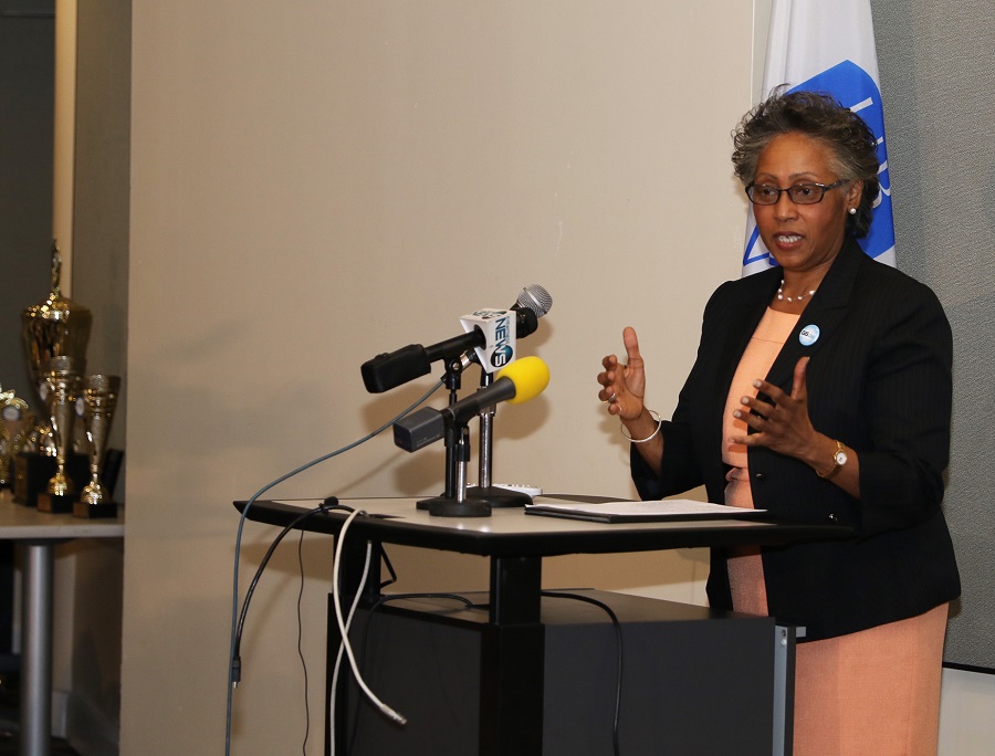
 Perlene Baker, Education Officer, Social Science Senior High Schools, MOE, announced the new initiative at the opening ceremony of the 8th Geographic Information Systems (GIS) Day celebrations and School Competition, Wednesday, November 14, 2018 at the Harry C. Moore Library at the University of The Bahamas (UB).
Ms. Baker explained that a GIS platform is included in the document for the new curriculum that will change the dynamics of how geography is taught. She said presently software is being used to provide knowledge for what is taking place in this era while The Bahamas continues to use old, ordinance survey maps. The new curriculum will upgrade the Ministry to 21st century standards. Ms. Baker also noted that there is an “urgent” need for 21st century training in GIS.
The focus of the week-long celebrations is to improve GIS literacy and to encourage institutions to integrate the technology in the existing curriculum.
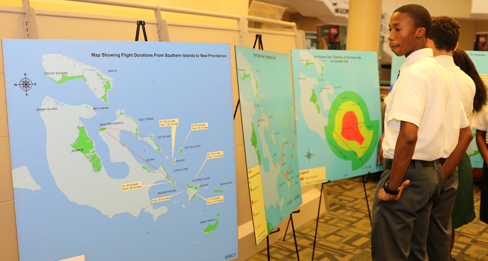
Students from public and private high schools in New Providence and the Family Islands demonstrated their knowledge and skills of geographic information education during the GIS competition.
Representing Doris Johnson Senior High School, Central Eleuthera High School, C. R. Walker Senior High School, Huntley Christie High School and Queen’s College, the students made group presentations that depicted the use of technology as disaster managers.
Their exhibits, which were on display, featured GIS maps including information on the projected path of a hurricane, people affected by Hurricane Geo in San Salvador, flight durations from Southern Islands to New Providence, Long Island flood zone areas, power supply areas, surge assessment, shelters and emergency services.
 Carolann Albury, Director, Bahamas National Geographic Information Systems Centre (BNGIS) said tools like GIS technology are needed to better position the country to increase its potential for informed decision making for a better quality of life.
“Education is key to all of this. From a technological perspective we recognize the importance for geo-spatial technologies and the need to integrate the technology to improve government’s efficiency. Knowing what, why and where things are and how they are interrelated or connected, having access to accurate and reliable data and information in a timely manner, are prerequisites to planning, research and analysis.
“These capabilities can influence change, influence policy decisions, can help to build a stronger nation, can help us be better stewards of our beautiful country and its resources. Everyone has a role to play. Embracing the technology is a must, procrastination is not an option.
Dr. Erin Hughey, Director, Disaster Services, Pacific Disaster Centre, USA, reflected on the importance of learning not only technology, but the science behind the technology, and understanding of the importance of authoritative data and of a nationwide system that ensures interoperability between the islands. She said GIS technology is a cross-cutting science that needs to be applied in every ministry, every element across all governments.
She challenged the students to look at how they may be able to use the technology to ask innovative questions that perhaps generations have not been able to ask because they did not have the data and information.
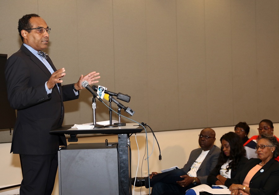 The Hon. Romauld Ferreira, Minister of the Environment and Housing, told the students that the work of preserving The Bahamas for future generations is their responsibility. He said, “I am looking to you to be a part of the solution to help to manage our country. We cannot do any kind of reflective management of our natural resources unless we know what is there. This is a basic and fundamental tenet. Once we know what is there and we apply the right information to have access to what we need to know, we can better manage our natural resources.”
The competition was a collaborative effort of UB, Pacific Disaster Center of the United States and BNGIS.
The week of activities also includes Curriculum Development training for stakeholders by representatives of Pacific Disaster Center of the United States.
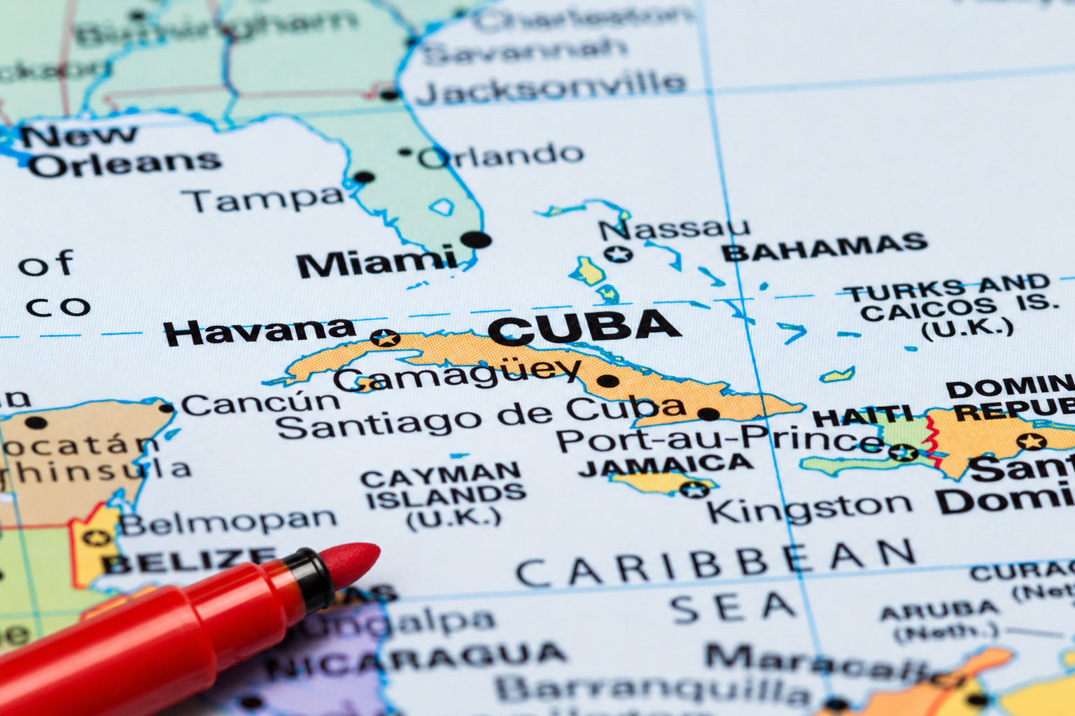
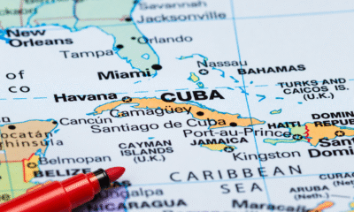
June 16, 2026 – Thirty-four years after formal negotiations began, Turks and Caicos Islands and The Bahamas are still working to define an agreed maritime boundary between the neighbouring archipelagos, a revelation emerging from a recent Turks and Caicos Cabinet summary which has brought renewed attention to a largely overlooked diplomatic and security issue.
A May 2026 Turks and Caicos Cabinet update suggests the long-running negotiations are continuing to advance. In August 2023, Bahamas Foreign Affairs Minister Fred Mitchell said efforts to draw an exact maritime boundary had been slowed by the challenge of gathering the mapping and locational data required for the exercise. The United Kingdom, which represents Turks and Caicos in the negotiations, has offered few details beyond confirming that both sides remain committed to maritime boundary delimitation talks.
The negotiations are not centred on a territorial dispute but rather on establishing a legally recognized maritime boundary under international law. Such agreements help determine jurisdiction over fisheries, maritime resources, law enforcement activities, environmental protection and migration control in the waters between neighbouring countries.
While the discussions focus on the boundary between The Bahamas and Turks and Caicos, the exercise is part of a wider maritime delimitation effort — the process of formally marking and agreeing upon where one country’s waters end and another’s begin. In comments to The Tribune in August 2023, Mitchell referenced similar boundary considerations involving the United States and Haiti, underscoring the broader regional importance of defining maritime jurisdictions in accordance with international law.
According to public statements from The Bahamas, formal negotiations between the two sides began in 1992 and were followed by technical discussions in 1996. After years of little public activity, talks resumed in 2023 and have continued through a series of engagements involving legal, maritime, security and geographic information specialists.
The importance of maritime boundaries was underscored by former Bahamas Foreign Affairs Minister Brent Symonette during maritime boundary discussions between The Bahamas and the United States in 2009. At the time, Symonette described clearly defined maritime borders as essential to national sovereignty, law enforcement, fisheries management, environmental protection and efforts to combat illegal migration. He also argued that agreed boundaries provide legal certainty and strengthen cooperation between neighbouring countries.
The United Kingdom, which represents Turks and Caicos in the negotiations, has offered few public details beyond confirming its commitment to the process. However, officials from the Foreign, Commonwealth and Development Office participated alongside TCI representatives during talks held in Nassau in August 2023. The Turks and Caicos delegation included then Permanent Secretary Wesley Clerveaux, whose responsibilities included Marine Affairs.
At this stage, the TCI Cabinet has only publicly identified the area under discussion as being south of “Point 1.” Information released by The Bahamas following a 2023 meeting indicates the negotiations concern waters between the southeastern Bahamas and the Turks and Caicos Islands. While no map has been made public, the available information places the discussions south of Bahamian islands including Mayaguana and Great Inagua. Exactly where the proposed boundary would meet the Turks and Caicos archipelago remains unclear from public records.
The latest Cabinet update offers no indication of when the negotiations may conclude. However, after more than three decades of intermittent discussions, recent references by both governments suggest efforts to finally draw the line between the two jurisdictions are continuing.
By Deandrea Hamilton
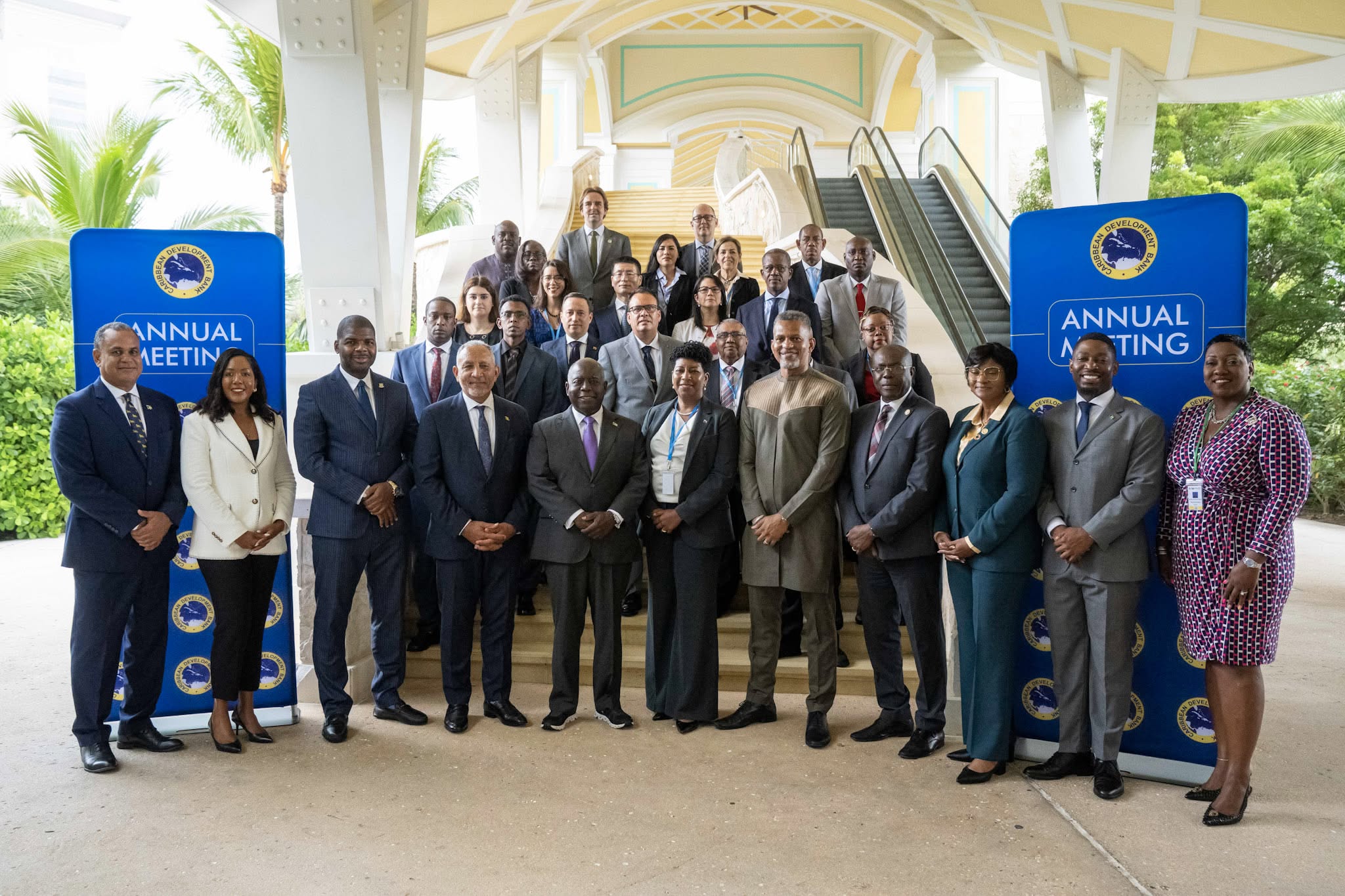
The Bahamas, June 9, 2026 – The Caribbean Development Bank’s annual gathering may have concluded in The Bahamas, but attention is already turning to Belize as leadership of the institution’s Board of Governors officially changed hands.
At the close of the 56th Annual Meeting in Nassau, outgoing Chairman and CDB Governor for The Bahamas, Michael Halkitis, formally transferred the chairmanship to Belize’s Dr. Hon. Osmond Martinez, continuing the Bank’s tradition of rotating leadership among its regional shareholders.
The handover capped a week of discussions focused on financing development in an increasingly uncertain global environment and strengthening the Caribbean’s ability to withstand economic and climate-related shocks.
One of the meeting’s most closely watched conversations centered on how multilateral development banks can better support vulnerable Small Island Developing States.
During the President’s Chat, titled Financing the Future: MDB Strategies for Uncertain Times, CDB President Daniel Best joined leaders from the OPEC Fund, the Central American Bank for Economic Integration and the Fund for Responding to Loss and Damage to discuss expanding development finance and building resilience.
OPEC Fund President Dr. Abdulhamid Alkhalifa emphasized that development institutions must move beyond responding to crises and instead help countries prepare for them.
“The real test is whether we can help countries move from strategy to implementation, and from implementation to results,” Alkhalifa said.
The discussions reflected a growing regional push for innovative financing solutions as Caribbean nations continue to confront climate vulnerability, infrastructure demands and economic uncertainty.
Beyond discussions on financing and resilience, the Annual Meeting also featured youth engagement activities, including the Youth FIRE Forum, where young Caribbean leaders participated in conversations about innovation, entrepreneurship, leadership and the future of regional development. Senior government officials, development professionals and youth delegates exchanged ideas on the challenges and opportunities facing the next generation, reinforcing a recurring message throughout the conference: that investments made today must ultimately improve opportunities for Caribbean youth tomorrow.
That theme was echoed by Bahamas Prime Minister Philip Davis, who used the opening ceremony to challenge regional leaders to invest in future generations.
“We must invest in the one asset that no agency can ever downgrade, and that no storm can ever wash away: the mind of a Caribbean child,” Davis told delegates.
With Belize now assuming the chairmanship, regional leaders say the focus remains on transforming ideas discussed in Nassau into tangible results for Caribbean people.
Angle by Deandrea Hamilton. Built with ChatGPT (AI). Magnetic Media — CAPTURING LIFE.

ABACO, BAHAMAS — Nearly two months after American sailor Lynette Hooker vanished in waters off Abaco, investigators are preparing to conduct a new search based on GPS and navigation data that reportedly challenges the account originally provided by her husband.
The case, which first drew international attention in early April, began when Brian Hooker told authorities that his wife was swept away after falling from an inflatable dinghy during rough conditions in waters near Elbow Cay.
Initial search efforts involving Bahamian and U.S. authorities covered extensive areas of the Sea of Abaco but failed to locate the missing Michigan woman.
Now, according to multiple U.S. media reports, investigators have obtained electronic navigation and GPS data that appears to place the couple’s dinghy in a different location from where searchers initially concentrated their efforts.
The new information has prompted authorities to reopen search operations and seek permission for divers to examine a more targeted area of the Sea of Abaco.
Unlike the broad search that followed Hooker’s disappearance, the renewed effort is expected to focus on a relatively shallow section of water, reportedly about 25 feet deep. Investigators believe the location may offer a better opportunity to recover evidence and potentially answer lingering questions surrounding the disappearance.
The latest development marks a significant shift in the investigation.
What began as a maritime search-and-rescue operation has evolved into a complex multinational investigation involving Bahamian authorities, the United States Coast Guard and the Federal Bureau of Investigation.
Brian Hooker was detained and questioned by Bahamian authorities following his wife’s disappearance but was later released without charges. While investigators have never publicly accused him of a crime, reports indicate he remains a person of interest as authorities continue to examine the circumstances surrounding the case.
Hooker has repeatedly denied any wrongdoing and has maintained that his wife accidentally fell overboard.
The investigation has intensified in recent weeks. U.S. authorities have reportedly seized the couple’s sailboat, Soulmate, transporting the vessel to Florida for forensic examination. Investigators are said to be reviewing onboard electronics, digital records and other potential evidence as part of the ongoing inquiry.
The case has also attracted attention from Lynette Hooker’s family, who have continued to press for answers and support efforts to locate her.
The renewed search comes after Brian Hooker returned to the United States following the disappearance. Reports indicate he cited family reasons, including concerns about his mother’s health, for leaving The Bahamas.
For investigators, however, the focus now appears fixed on the newly identified search area and the electronic evidence that led them there.
Whether the latest operation produces answers remains to be seen. But nearly eight weeks after Lynette Hooker disappeared in the waters of Abaco, authorities believe new technology and new information may finally provide a clearer picture of what happened that night.


-

 News5 days ago
Platinum Sponsor Beaches Turks & Caicos celebrates top Corporate Engagement title at DG’s 5K 2026
-

 News5 days ago
Beaches Turks & Caicos wrapped up another successful Provo Men’s Premier League season
-
 News6 days ago
DDME LAUNCHES 2026 ATLANTIC HURRICANE SEASON WITH CHURCH VISITS
-

 News6 days ago
Experience Turks and Caicos and Statistics Authority Publish Latest Visitor Exit Survey Report
-
 Bahamas News6 days ago
Where to Draw the Line? TCI and Bahamas Advance Maritime Boundary Talks
-

 News6 days ago
The Cost of Unprotected Culture