
Caribbean News
WATCHES AND WARNINGS

June 27, 2022 – The government of Trinidad and Tobago has issued a Tropical Storm Warning for Trinidad, Tobago, and Grenada and its dependencies.
SUMMARY OF WATCHES AND WARNINGS IN EFFECT:
A Tropical Storm Warning is in effect for…
- Trinidad and Tobago
-
Grenada and its dependencies
A Tropical Storm Warning means that tropical storm conditions are expected somewhere within the warning area within 36 hours. Interests elsewhere in the Windward Islands, the northern coast of Venezuela, and the ABC Islands should monitor the progress of this system.
For storm information specific to your area, please monitor products issued by your national meteorological service.
DISCUSSION AND OUTLOOK
At 500 PM AST (2100 UTC), the disturbance was centered near latitude 8.6 North, longitude 50.9 West. The system is moving toward the west-northwest near 18 mph (30 km/h), and this general motion is expected to continue for the next few days. On the forecast track, the system will pass near or over portions of the southern Windward Island by late Tuesday, and move over the southern Caribbean Sea or near the northern coast of Venezuela on Wednesday and Thursday.
Maximum sustained winds are near 40 mph (65 km/h) with higher gusts. Some strengthening is forecast during the next 48 hours.
Conditions appear conducive for development, and the disturbance will likely become a tropical storm before reaching the southern Windward Islands.
* Formation chance through 48 hours…high…70 percent.
* Formation chance through 5 days…high…90 percent.
Tropical-storm-force winds extend outward up to 60 miles (95 km) north of the center. The estimated minimum central pressure is 1009 mb (29.80 inches).
HAZARDS AFFECTING LAND
Key messages for Potential Tropical Cyclone Two can be found in the Tropical Cyclone Discussion under AWIPS header MIATCDAT2 and WMO header WTNT42 KNHC.
RAINFALL: The Potential Tropical Cyclone is expected to produce heavy rain across the southern Windward Islands and the northeastern coast of Venezuela starting Tuesday night into Wednesday. The following storm total rainfall amounts are expected:
Islands from Guadeloupe to St. Lucia: 1 to 3 inches.
St. Vincent, the Grenadines, and Barbados: 3 to 4 inches.
Grenada, Trinidad and Tobago, and northeastern Venezuela: 4 to 6 inches.
WIND: Tropical storm conditions are expected in the warning area by late Tuesday.
Under Watch at the National Hurricane Center
- Central Tropical Atlantic:A tropical wave located about 700 miles east-southeast of the southern Windward Islands is producing a large area of showers and thunderstorms. Environmental conditions appear conducive for development, and a tropical depression or a tropical storm is likely to form during the next day or so before the system reaches the Windward Islands Tuesday night or possibly while moving westward across the southern
 Caribbean Sea Wednesday through Friday.

A NOAA Hurricane Hunter aircraft is currently investigating the system and has found winds to tropical storm force. Interests in the Windward Islands and along the northeastern coast of Venezuela should monitor the progress of this system, and tropical storm watches or warnings could be required for portions of these areas later today. Regardless of development, locally heavy rainfall is possible over the Windward Islands and the northeastern coast of Venezuela Tuesday night and Wednesday.*
Formation chance through 48 hours…high…70 percent.*
Formation chance through 5 days…high…90 percent.
- Northern Gulf of Mexico:Disorganized showers and thunderstorms over the north-central Gulf of Mexico are associated with a trough of low pressure. Development of this system is expected to be slow to occur while it moves west-southwestward at about 10 mph toward the northwestern Gulf of Mexico and approaches the coasts of southern Texas and northeastern Mexico during the next few days.
* Formation chance through 48 hours…low…10 percent.
* Formation chance through 5 days…low…20 percent.
- Eastern Tropical Atlantic:A tropical wave located several hundred miles southwest of the Cabo Verde Islands is producing disorganized showers and thunderstorms. Environmental conditions could become conducive for gradual development later this week while the system moves west- northwestward at around 15 mph over the central tropical Atlantic.
* Formation chance through 48 hours…low…near 0 percent.
* Formation chance through 5 days…low…20 percent.
Caribbean News
From Pathways to Investment: Tackling the US $6 Billion Food Challenge for the Caribbean

By Kenroy Roach
The Caribbean’s food systems challenge is fast evolving into a broader development challenge.
Despite decades of policy attention and investment, the region remains one of the most food import-dependent in the world, spending over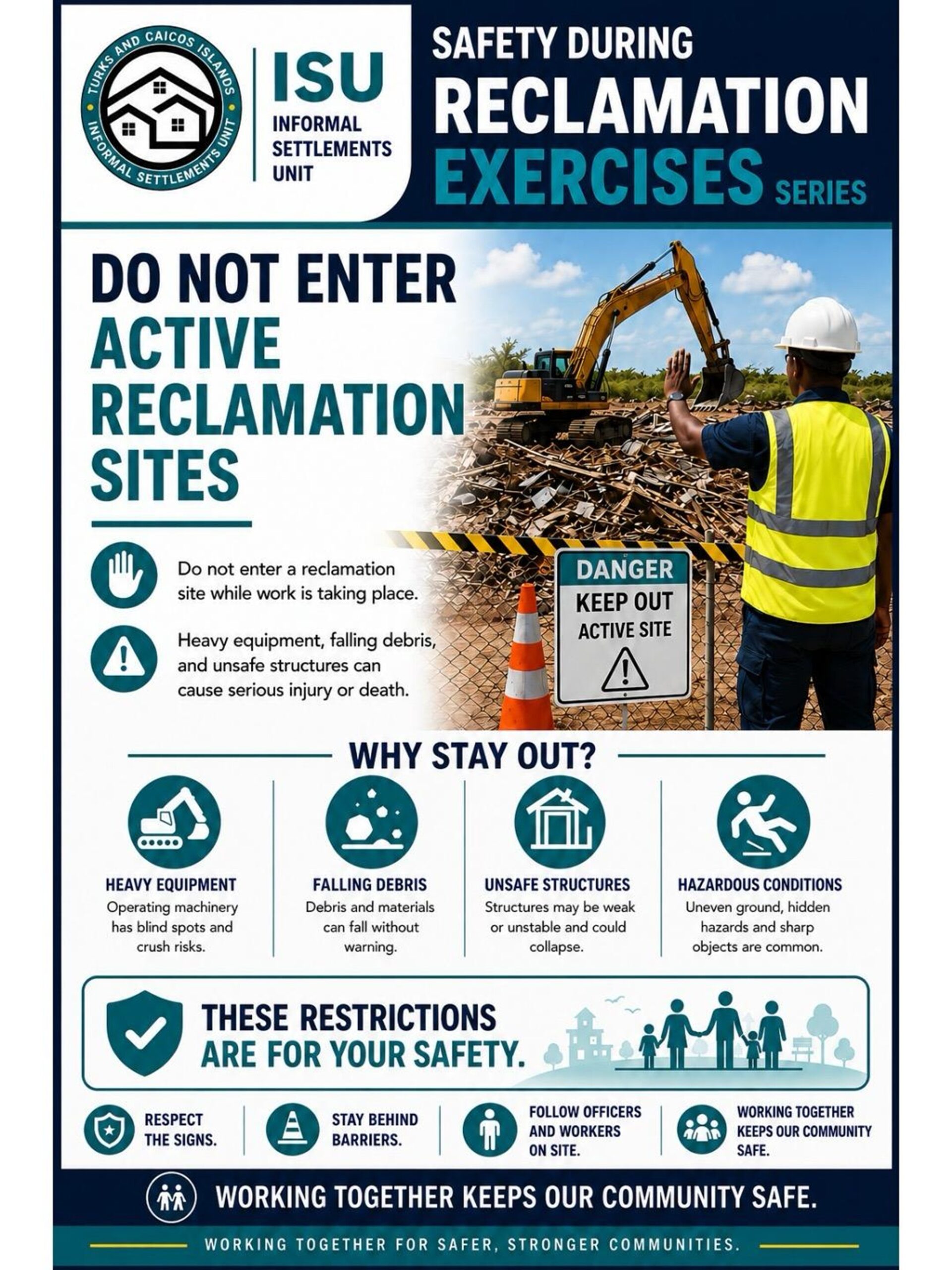 US$6 billion annually. At the same time, countries continue to grapple with food insecurity, high rates of diet-related non-communicable diseases, climate vulnerability, and exposure to external shocks that can disrupt supply chains and drive up food prices almost overnight.
For Small Island Developing States (SIDS), food security has shifted from an agriculture focus alone, it’s about economic resilience, health, climate resilience and sustainable growth.
Recognizing this reality, Caribbean governments have elevated food systems transformation as a regional priority through the CARICOM 25 x 25 Plus Five Agenda, which seeks to reduce food import dependence while strengthening domestic production, regional trade, and resilience. Across Barbados and the Eastern Caribbean, governments have also developed National Food Systems Pathways that identify the investments, partnerships, and policy reforms needed to transform food systems and accelerate progress toward the Sustainable Development Goals (SDGs).
Yet one challenge has remained persistent: financing.
In the face of high levels of public debt and limited fiscal space, while public investment remains critical, Caribbean governments simply cannot shoulder the financing burden alone. Transforming food systems at scale requires mobilizing far greater private capital, alongside development finance and public resources.
This was the rationale behind the recent convened in Barbados.
The Forum brought together governments, investors, international financial institutions, private sector leaders, regional organizations, and the United Nations around a simple proposition: food systems should be viewed not only as a development priority, but also as an investable asset class.
A distinguishing feature of the innovative gathering was its focus on attracting private investment—particularly private equity, impact investment, and blended finance solutions capable of supporting businesses and infrastructure across food value chains. By helping enterprises access growth capital and connecting investors with scalable opportunities, the initiative sought to unlock financing that complements public investment rather than adding to already constrained public balance sheets.
A key outcome was the launch of a regional Deal Book comprising approximately US$320 million in investment opportunities across seven countries, spanning agriculture, fisheries, agro-processing, logistics, and strategic food systems infrastructure. The Deal Book created a practical bridge between capital seeking opportunities and opportunities seeking capital, while enabling direct engagement between governments, enterprises, and investors.
The results were encouraging.
Across four sector-focused deal rooms, participants explored investment-ready and near-investment-ready opportunities and discussed blended finance private equity, risk-sharing, and partnerships to advance projects toward implementation.
The Forum highlighted a shift in perspective: food systems are now seen as strategic drivers of economic diversification, resilience, competitiveness, and growth. Investments across production, processing, logistics, and distribution can strengthen regional supply chains, create new businesses, generate jobs, and reduce vulnerability to external shocks.
For the United Nations, this experience reinforced an important lesson.
Transforming food systems requires more than the technical expertise of individual agencies. It requires integrated solutions that connect agriculture, nutrition, health, climate resilience, trade, private sector development, and financing.
This is where the Resident Coordinator System plays a critical role.
Across Barbados and the Eastern Caribbean, the Resident Coordinator Office has united UN system capabilities around a common food systems agenda. Working with FAO, WFP, the UN Food Systems Coordination Hub, and other partners, the RCO has helped align policy support, technical expertise, partnerships, and financing with nationally identified priorities.
The Forum demonstrated this integrated approach by convening governments, investors, development finance institutions, private sector actors, and UN agencies around a common objective. It showcased the UN’s comparative advantage as a trusted broker capable of connecting development priorities with investment opportunities.
The Forum’s success will be measured not by dialogue generated, but by investments mobilized, businesses expanded, and progress made toward resilient, competitive Caribbean food systems across the Caribbean.
Its most important outcome may therefore be what comes next.
The work starts now.
Kenroy Roach is Head of the UN Resident Coordinator Office for Barbados and the Eastern Caribbean

Deandrea Hamilton | Editor
What if we rejected the notion that Haitians flourish best only when they are outside of Haiti? What if the next great Haitian success story is not another exodus, but a hearty homecoming? For years, the conversation has been steered toward ushering Haitians out of Haiti. Having witnessed the indomitability of the Haitian people, I feel compelled to point out that a U.S. Supreme Court decision may force us to see what has been staring us in the face all along: the solution may be hundreds of thousands of Haitians themselves.
As thousands of Haitians in the United States prepare for the end of Temporary Protected Status (TPS)—a humanitarian programme created under U.S. law as a temporary protection, not a permanent immigration pathway—the conversation should extend beyond American immigration policy. It should turn to Haiti’s future.
History offers perspective. An estimated 20,000 to 30,000 Haitian revolutionaries defeated Napoleon’s forces and secured independence in 1804, making Haiti the first Black republic and the second independent nation in the Western Hemisphere. Now imagine the force of more than 300,000 Haitians returning with skills, discipline and experience gained in the world’s largest economy.
Add to that, Haiti is itself sending a clear message: the country needs its people.
I found a report from the Armed Forces of Haiti (FAd’H) which recently announced that 17,722 applicants came forward in just 11 days during its latest recruitment campaign. A second recruitment phase is planned and will specifically target professionals in law, engineering, medicine and other technical fields, as the country works to strengthen institutions, restore security and prepare for the future.
Coincidentally—or perhaps providentially—many of the Haitians now facing the end of TPS are not returning empty-handed. They include thousands of nursing assistants, caregivers, mechanics, delivery drivers, warehouse workers, agricultural workers, hotel employees, cooks, retail workers, security officers, landscapers, school assistants and property managers. They are returning with years of experience gained inside the world’s largest economy. They have learned trades, embraced innovation, worked within structured systems, met professional standards and developed the practical skills every successful nation depends upon.
These are not simply returning migrants. They may be the human capital Haiti needs most.
For generations, Haitians have become experts at surviving and thriving in other lands. They have endured political upheaval, natural disasters, poverty, insecurity and displacement with extraordinary resilience. But survival and escape cannot build their nation. At some point, survival must give way to rebuilding. And hope for home must command action. It requires people willing to invest not only in their families, but in the future of the country itself.
For decades, the Haitian diaspora has faithfully sustained families through remittances. That generosity has been indispensable. But rebuilding Haiti will require something remittances alone cannot provide. It will require human capital—teachers in classrooms, nurses in clinics, engineers on construction sites, entrepreneurs creating jobs, police protecting communities, judges strengthening the rule of law, and citizens committed to rebuilding the institutions that hold a nation together.
Anyone who has spent time in Haiti knows it is far more than the headlines. It is a nation of breathtaking mountains, secret waterfalls, fertile valleys and rice paddies. It is a land of remarkable creativity, deep faith, natural entrepreneurs, rich culture and resilient people. It is the oldest republic in Latin America and the Caribbean and the first Black republic in the modern world. Above all, it is a country worth fighting for.
Perhaps the fight itself now needs to change.
For too long, the world has defined Haiti by its crises. Haitians know it by its promise. The next fight should not simply be to survive, but to rebuild—to inject a new generation of skilled workers, professionals and entrepreneurs into a nation that desperately needs their mental muscle, their experience and their vision.
Returning home will not be easy, but what if returning became rewarding and the contribution of these thousands of Haitians became the catalyst for transforming or reforming the nation they call home?
No country can export its builders forever and expect to become stronger. Haiti has spent decades sharing its greatest resource with the world—its people. Perhaps the next chapter in Haiti’s remarkable story is not another exodus, but this very homecoming.
The next chapter of Haiti’s story should not be written at an airport departure gate, nor should it be framed only as horror for those whose TPS protections are ending. The real test now is whether advocates, attorneys, governments and the wider Caribbean do more than wave goodbye. We must help more than 330,000 Haitians find their footing, settle back in, put their skills to work and build the Haiti that generations of Haitians have always deserved.
Research & Development supported by ChatGPT AI
Caribbean News
Sandals® and Beaches® Resorts Launch Rebranded Loyalty Program, ‘Island Insiders Club’

~All-inclusive resort company elevates rewards program, offering expanded benefits and member-only events & experiences, rooted in the spirit of the islands~
MONTEGO BAY, JAMAICA, July 2, 2026 — Sandals and Beaches Resorts unveiled today the introduction of its new Island Insiders Club, the next chapter of its refreshed loyalty program. Replacing the long-running Sandals Select Rewards program (established in 2008), the new program is designed to elevate the guest experience with a more immersive approach to awards and recognition. Effective July 1, 2026, the transition will preserve members’ current status and existing benefits, while expanding access to enhanced rewards, exclusive events and enriched experiences that bring members closer to the Caribbean.
“We are expanding how loyalty shows up across every stay to encapsulate what our loyal members already are — an inside part of the Sandals and Beaches family,” stated # SVP of Loyalty at Unique Vacations, Inc., worldwide representative of Sandals and Beaches Resorts. “We developed this program side-by-side with the guests who know the resorts, the islands, and the people best, drawing on extensive focus groups, surveys, and direct feedback. The result is a loyalty experience that goes far beyond points, and is felt in every welcome home.”
Guests can enroll in Island Insiders Club before their very first visit, and begin earning status after their first stay. The program features seven levels of loyalty, the highest being Ambassador, followed by Pearl, Diamond, Emerald, Sapphire, Coral and Shell (which replaces the former Select tier).
More Access. More Recognition. More Caribbean.
Sandals Select Rewards members will roll over to the Island Insiders Club on July 1, 2026, maintaining their status and benefits with no reset.
Island Insiders Club highlights include:
- Choice of Insider Reward: A flexible credit that lets Insiders choose the experiences that best match their vacation style, from relaxing at the Red Lane Spa to embarking on an adventure with Island Routes.
- The Insiders Shop: A private online merchandise store featuring premium collections and limited-edition drops, including handcrafted artisanal pieces, available exclusively for Island Insiders.
- Room Upgrade Hotline: Now available exclusively for members, Insiders can request a room upgrade 30 days prior to travel and receive up to 50% off their upgrade when they call a dedicated number.
- Dedicated VIP Concierge Line: A one-stop, full-service customer care team supporting Diamond, Pearl, and Ambassador members throughout their vacation journey, helping to book their flights, tours, special requests and more.
- Expanded Insider Experiences, On and Off Resort: Exclusive Insider events including specialty weeks focused on diving, autism inclusion, and culinary experiences on resort. Plus, access to a series of experiential events across the globe.
- 20% off Managers Wine List Discount: Returning members receive 20% off the Manager’s Wine List, offering another elevated touch for dinners, celebrations, and special moments on resort.
- $200 Laundry Service Credit: Ambassador members will receive a $200 laundry service credit, adding an extra layer of ease and convenience to longer stays.
- Complimentary Week Stay: A complimentary 7-night stay at any resort of choice is awarded to members after every 70 paid nights.
- New Member Incentive: Those “newly inside” who book and travel will receive 5,000 bonus points after their first stay.
As always, Insiders enjoy special access to cabanas, a complimentary photo on every trip, member discounts on everything from retail and watersports to candlelight dinners, and added savings on future stays at the loyalty lounge.
New Name, New Look and a Nod to Nostalgia
The Island Insiders Club’s refreshed visual identity is built around a simple pair of sandals, now the signature symbol of Island Insiders Club and a throwback to an Insider tradition that’s been worn for decades, from vintage gold and silver pendants in the early days to the leather necklaces shared at member events today.
The new brand look will roll out across consumer touchpoints in the months ahead, from dedicated Island Insiders Club lounges to on resort signage, marketing and sales channels, digital and more, bringing Island Insiders Club to life through a modern design and multiplatform approach.
An Exclusive Inside Scoop
In true Insider fashion, Island Insiders Club was first unveiled to the brand’s most loyal members during a special “Step Inside Our Sandals” video conference. Designed as an Insider-first briefing, the call gives top members an early look at brand news and upcoming developments. Hosted by Peter Menges, the event walked members through the highlights of the new program, what to expect, and the refreshed look and feel of Island Insiders Club, before Sandals and Beaches Resorts’ Executive Chairman Adam Stewart gave an exclusive look at what’s next and the reimagining of three iconic Sandals Resorts in Jamaica.
For more information about Island Insiders Club or to become a member, visit: www.sandals.com/islandinsidersclub.
Go behind-the-scenes of the Island Insiders Club with Peter Menges on the Sandals Palmcast and read the latest on the Sandals blog.


-

 Caribbean News1 week ago
Sandals® and Beaches® Resorts Launch Rebranded Loyalty Program, ‘Island Insiders Club’
-
 News1 week ago
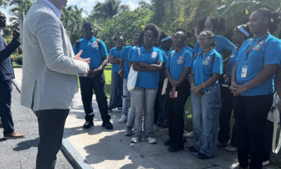
Beaches Turks & Caicos resort hosts high school tourism clubs from Providenciales and North Caicos
-

 Caribbean News4 days ago
Returning Haitians Could Be the Answer Haiti Has Been Praying For
-
 News1 week ago
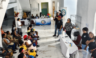
Community Comes Together as ISU Community Engagement Exercise Delivers Essential Services in Kew Town
-

 Health4 days ago
Turks & Caicos Hotel and Tourism Association Secures Landmark Health Insurance Partnership for Tourism Workforce
-

 News4 days ago
COURT DENIES BAIL; MISICK, HANCHELL AND CHAL MISICK TO REMAIN BEHIND BARS DURING APPEAL
-

 Caribbean News1 week ago
First Caymanian Drafted to NHL as Jaxon Cover Makes History
-

 News4 days ago
Turks & Caicos Visitors Spend $670 Million in 90 Days as Survey Reveals Top Resorts