
Bahamas News
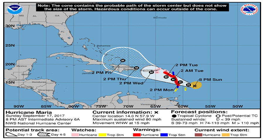
MARIA BECOMES A HURRICANE
PM: Project delivers on promise and invests in youth, sports and national development
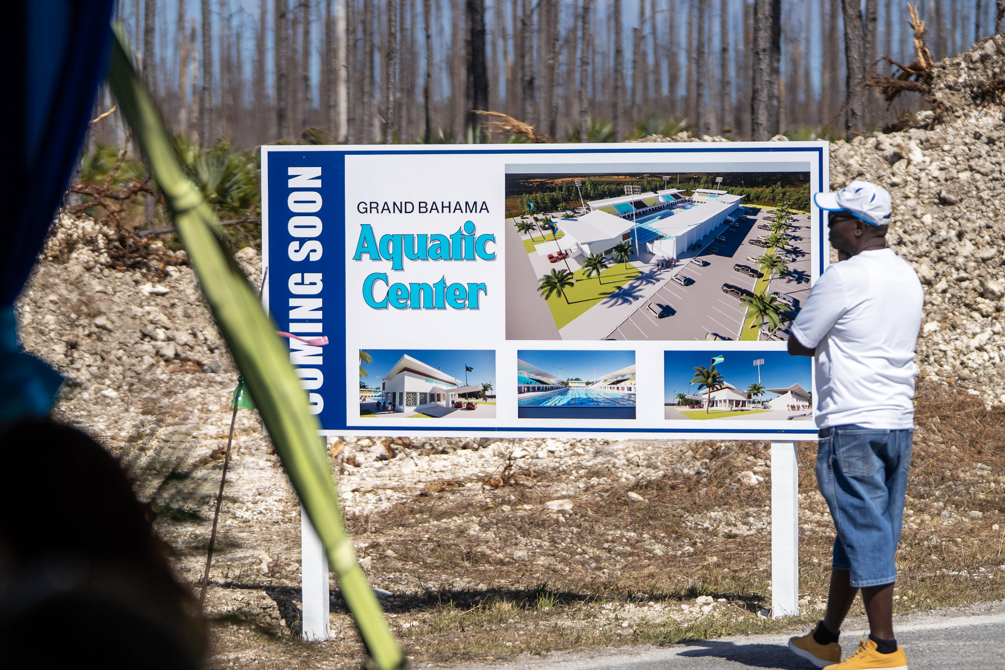
GRAND BAHAMA, The Bahamas — Calling it the fulfillment of a major commitment to the island, Prime Minister Philip Davis led the official groundbreaking for the Grand Bahama Aquatic Centre, a facility the government says will transform sports development and create new opportunities for young athletes.
Speaking at the Grand Bahama Sports Complex on February 12, the Prime Minister said the project represents more than bricks and mortar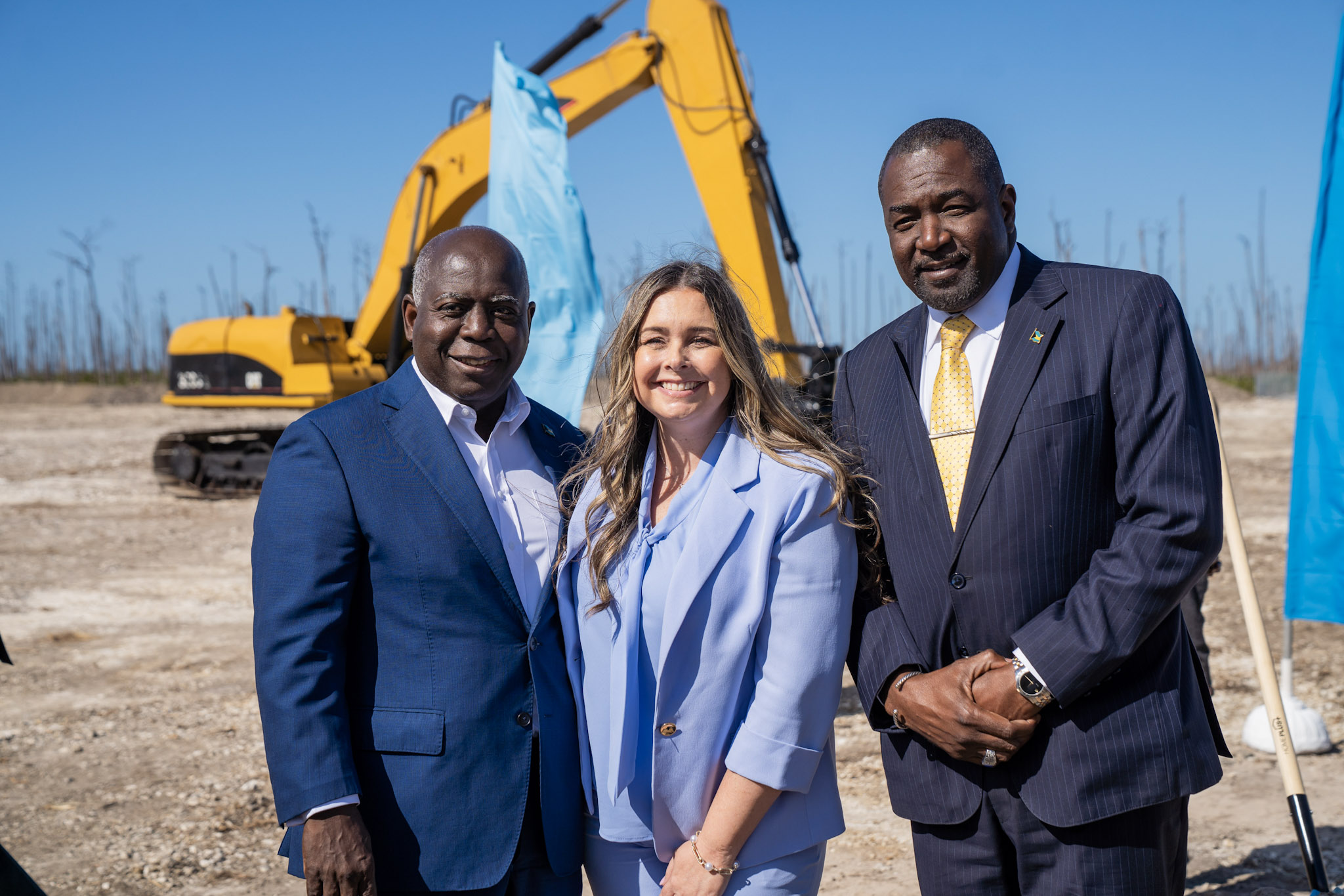 — it is an investment in people, national pride and long-term economic activity. The planned complex will feature a modern 50-metre competition pool, designed to meet international standards for training and regional and global swim meets. Davis said the facility will give Bahamian swimmers a home capable of producing world-class performance while also providing a space for community recreation, learn-to-swim programmes and water safety training.
He noted that Grand Bahama has long produced outstanding athletes despite limited infrastructure and said the new centre is intended to correct that imbalance, positioning the island as a hub for aquatic sports and sports tourism.
The Prime Minister also linked the development to the broader national recovery and revitalisation of Grand Bahama, describing the project as part of a strategy to expand opportunities for young people, create jobs during construction and stimulate activity for small businesses once operational.
The Aquatic Centre, he said, stands as proof that promises made to Grand Bahama are being delivered.
The project is expected to support athlete development, attract competitions, and provide a safe, modern environment for residents to access swimming and water-based programmes for generations to come.
Angle by Deandrea Hamilton. Built with ChatGPT (AI). Magnetic Media — CAPTURING LIFE.

The Bahamas, February 15, 2026 – For the better part of three years, Bahamians have been told that major Afreximbank financing would help transform access to capital, rebuild infrastructure and unlock economic growth across the islands. The headline figures are large. The signing ceremonies are high profile. The language is ambitious. What remains far harder to see is the measurable impact in the daily lives of the people those announcements are meant to serve.
The Government’s push to secure up to $100 million from Afreximbank for roughly 200 miles of Family Island roads dates back to 2025. In its February 11 disclosure, the bank outlined a receivables-discounting facility — a structure that allows a contractor to be paid early once work is completed, certified and invoiced, with the Government settling the bill later. It is not cash placed into the economy upfront. It does not, by itself, build a single mile of road. Every dollar depends on work first being delivered and approved.
The wider framework has been described as support for “climate-resilient and trade-enhancing infrastructure,” a phrase that, in practical terms, should mean projects that lower the cost of doing business, move people and goods faster, and keep the economy functioning. But for communities, that promise becomes real only when the projects are named, the standards are defined and a clear timeline is given for when work will begin — and when it will be finished.
Bahamians have seen this moment before.
In 2023, a $30 million Afreximbank facility for the Bahamas Development Bank was hailed as a breakthrough that would expand access to financing for local enterprise. It worked in one immediate and measurable way: it encouraged businesses to apply. Established, revenue-generating Bahamian companies responded to the call, prepared plans, and entered a process they believed had been capitalised to support growth. The unanswered question is how much of that capital has reached the private sector in a form that allowed those businesses to expand, hire and generate new economic activity.
Because development is not measured in the size of announcements.
It is measured in loans disbursed, projects completed and businesses expanded.
The pattern is becoming difficult to ignore. In June 2024, when Afreximbank held its inaugural Caribbean Annual Meetings in Nassau, Grand Bahama was presented as the future home of an Afro-Caribbean marketplace said to carry tens of millions of dollars in investment. What was confirmed at that stage was a $1.86 million project-preparation facility — funding for studies and planning to make the development bankable, not construction financing. The larger build-out remains dependent on additional approvals, land acquisition and further capital.
This distinction — between financing announced and financing that produces visible, measurable outcomes — is now at the centre of the national conversation.
Because while the numbers grow larger on paper, entrepreneurs still describe access to capital as out of reach, and communities across the Family Islands are still waiting to see where the work will start.
And in an economy where stalled growth translates into lost opportunity, rising frustration and real social consequences, the gap between promise and delivery is no longer a communications issue.
It is an inability to convert announcements into outcomes.
Angle by Deandrea Hamilton. Built with ChatGPT (AI). Magnetic Media — CAPTURING LIFE.

A hardline strategy that reduced murders, gunfire, and collateral deaths
The Bahamas, February 8, 2026 – What happens when police stop routinely granting bail to high-risk suspects and aggressively execute outstanding warrants? In The Bahamas, the answer in 2025 was fewer murders, fewer gunshots, and safer communities.
The Royal Bahamas Police Force arrested 4,337 individuals on outstanding warrants last year, ensuring suspects were brought directly before the courts instead of being released back onto the streets. At the same time, police significantly curtailed the use of police bail for high-risk and repeat offenders, particularly those already entangled in violent disputes.
Police Commissioner Shanta Knowles said the shift was informed by hard lessons from previous years. Intelligence reviews showed that many homicide victims were not random targets, but men already wanted by law enforcement and — critically — by other criminals. When released on bail, those individuals often became targets themselves, triggering retaliatory shootings that spilled into neighbourhoods, roadways and public spaces.
By keeping high-risk suspects in custody pending court appearances, police say they disrupted that cycle — removing both potential offenders and potential victims from the streets.
The impact was stark. Murders declined by 31 percent in 2025, falling from 120 in 2024 to 83, the largest percentage decrease in homicides since national tracking began in 1963 and the lowest murder count in nearly two decades.
Police leaders say the strategy also reduced the collateral damage that had increasingly alarmed communities. Innocent residents had been caught in “sprays of gunfire” as targeted attacks unfolded in residential areas, at traffic stops, and in public settings.
Gun-violence indicators reflected the change. Gunshot reports fell by 35 percent, while incidents detected by ShotSpotter technology declined by 29 percent, confirming that fewer shots were being fired across the country.
“Gunshots ringing out and cutting through our peaceful paradise were down remarkably,” Commissioner Knowles said, attributing the improvement to decisive enforcement, tighter bail practices, and sustained pressure on offenders.
Police also intensified enforcement against breach of bail conditions, charging and detaining more suspects than in any previous reporting period. Officers say the approach removed the opportunity for repeat offending while matters were before the courts.
Police leadership said the results go beyond statistics. By limiting bail for high-risk suspects and executing warrants at scale, the strategy saved lives, protected bystanders, and restored confidence in public safety.
In 2025, fewer people were hunted, fewer bullets were fired, and fewer families were left grieving — a shift police say was no accident, but the result of deliberate, hardline choices.
Angle by Deandrea Hamilton. Built with ChatGPT (AI). Magnetic Media — CAPTURING LIFE.


-
 News6 days ago
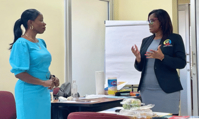
DDME Staff Strengthen Disaster Management Capacity Through Professional Development Workshop
-

 Caribbean News7 days ago
Liberty Caribbean Supports Regional Forum on AI, Cyber Resilience and Digital Inclusion
-

 News6 days ago
The Turks and Caicos Islands Set Positive Start to 2026 with Increase in January Stayover Arrivals