Bahamas News
Freaky Weather includes Waterspouts, Severe Flooding and fish in Backyards

By Dana Malcolm & Deandrea Hamilton
Staff Writer
#TheBahamas, May 19, 2022 – A waterspout whirling its way onto shore in the west, images of submerged cars, impassable roads and even fish darting around in a flooded backyard were the testimony of Nassau’s extreme weather weekend.
The Bahamas Department of meteorology had predicted severe weather from Friday midday to Saturday warning of,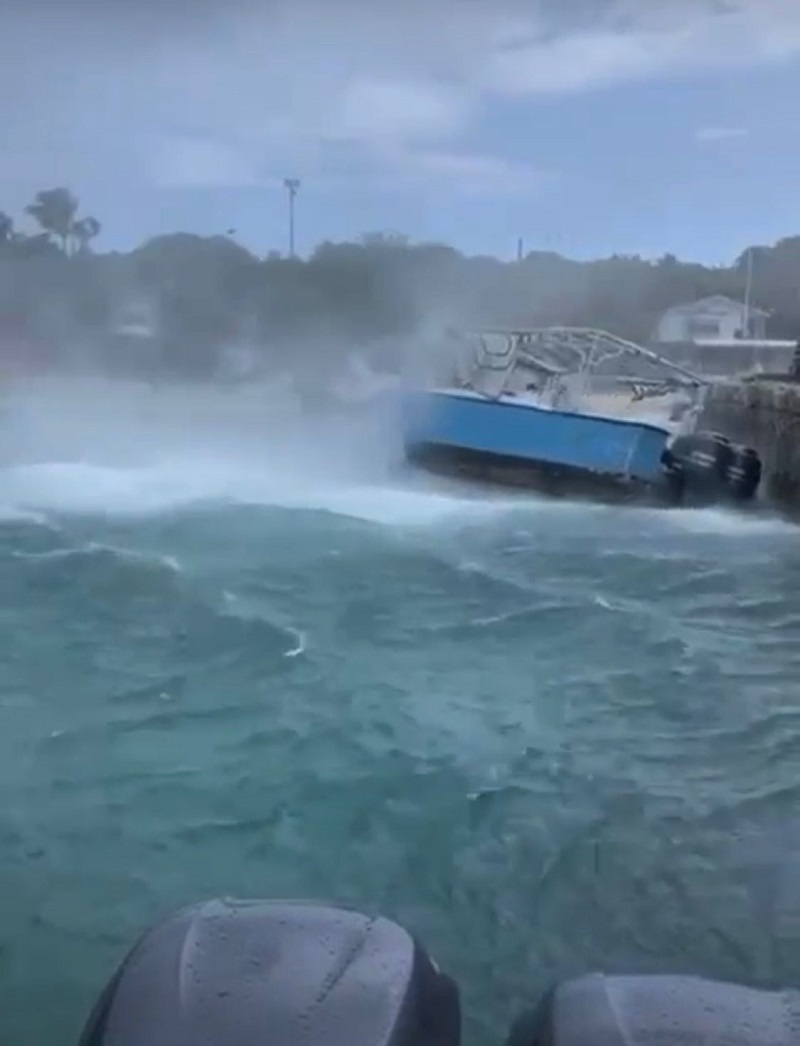
Reports of hail, the freakish funnel cloud, downpour flooded streets, submerged cars and stranded workers trying to get home made for a shocking weekend.
There were dramatic videos of the forecast, waterspouts, which made an appearance near seaside restaurants Sapodilla Bay and Traveller’s Rest. The ‘water tornado’ slashing against parked cars, producing whipping winds and tossing water into the restaurant elicited screams and frantic activity as residents could be heard rushing to safety.
The storm is unseasonably early with the official start to the hurricane season still two weeks away; but it maintains a trend for severe weather consistently appearing well ahead of the official June 1 start.
On Tuesday waterspouts erupted in the bay off Harbour Island, Eleuthera, also in The Bahamas as the country was inundated this week with SEVERE WEATHER ALERTS issued by The Bahamas Department of Meteorology.
The latest forecast as weekend approaches is there will be more of the same.
“EXTENDED FORECAST (FOR THE NEXT TWO DAYS): A TROPICAL WAVE, SKIRTING THE
SOUTHERN PERIPHERY OF THE BAHAMAS, WILL PROGRESSIVELY MOVE WESTWARDS AND
INFLUENCE AN INFLUX OF MOISTURE NORTHWESTWARDS OVER THE BAHAMAS, KEEPING 
RAIN CHANCES IN THE FORECAST INTO SATURDAY.”
The first tropical wave of 2022 has been identified but a pre-season storm is not yet expected. There have been pre-season tropical storms for the past seven years in a row according to WWLTV and the season is expected to be more severe than usual.
“An above-average season with major hurricane landfalls in the U.S.and in the Caribbean is unfortunately likely. Accuweather experts predict.
“16-20 named storms and six to eight hurricanes. Of those hurricanes, about three to five are forecast to reach major hurricane status.”
Boaters and swimmers in the two archipelagos – The Bahamas and Turks and Caicos Islands – were warned to be cautious as well, “BOATERS SHOULD REMAIN VIGILANT DUE TO THE THREAT OF POSSIBLE WATERSPOUT ACTIVITY. BEACHGOERS SHOULD EXERCISE CAUTION DUE TO THE RISK OF RIP CURRENTS,” the Meteorology Department said.