
Bahamas News
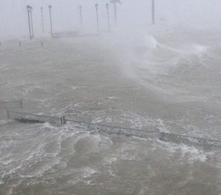
Hurricane Dorian stalls over Grand Bahama, moving 1 mile per hour, ALL Clear for some islands
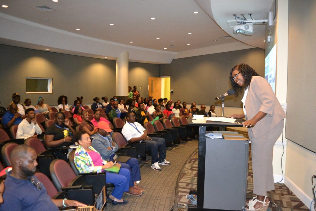
Nassau, THE BAHAMAS — Some of the most successful and accomplished professionals and business leaders in the country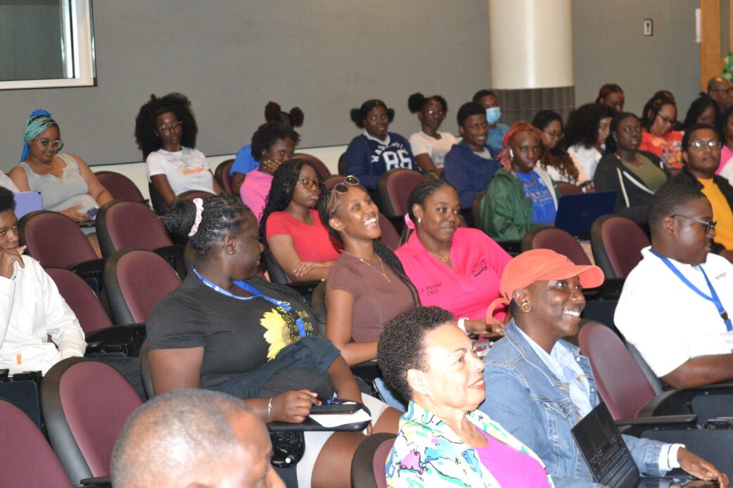 recently shared their experiences and nuggets of wisdom with students at University of The Bahamas (UB) about thriving in a wide range of careers.
The University Centre for Counselling and Career Services and the Career and Job Placement Advisory Unit collaborated to host the 2024 Career Symposium which brought students face to face with leaders in the careers to which they aspire.
Vice President of Academic Affairs, Dr. Maria Oriakhi, said the symposium was key to developing potential as university students strive to leave their mark on the world.
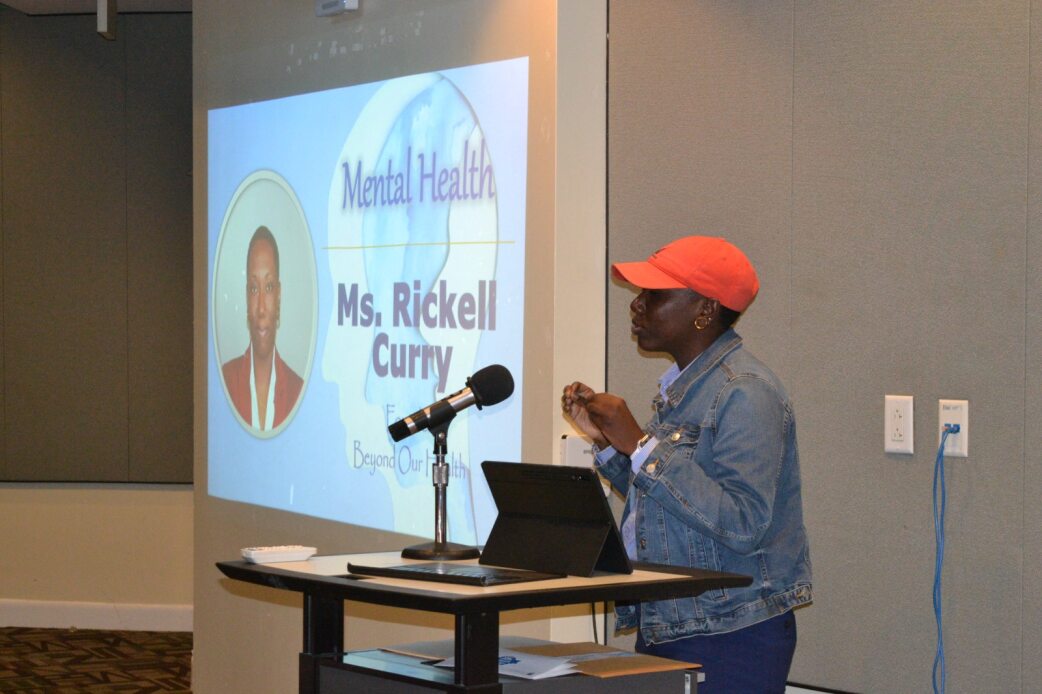
Ms. Rickell Curry
“In the spirit of collaboration and growth, let us engage in meaningful dialogue, cultivate relationships, and harness the power of collective wisdom to shape our futures,” said Dr. Oriakhi. “Together, let us embark on this journey of exploration and discovery, united in our commitment to realizing our fullest potential and making meaningful contributions to our communities and beyond.”
Promoting careers in psychology, Ms. Curry noted that psychologists are equipped with the ability to help others, troubleshoot areas of weakness within themselves, and become better people and professionals in the process.
“The floor is yours to be able to explore. There’s no job where you don’t have to deal with people, so learning, even if you get a bachelor’s in psychology, is a great grounding,” she said.
Dr. Darville, one of few interventional radiologists in The Bahamas, offered another nugget of advice on choosing an area of study.
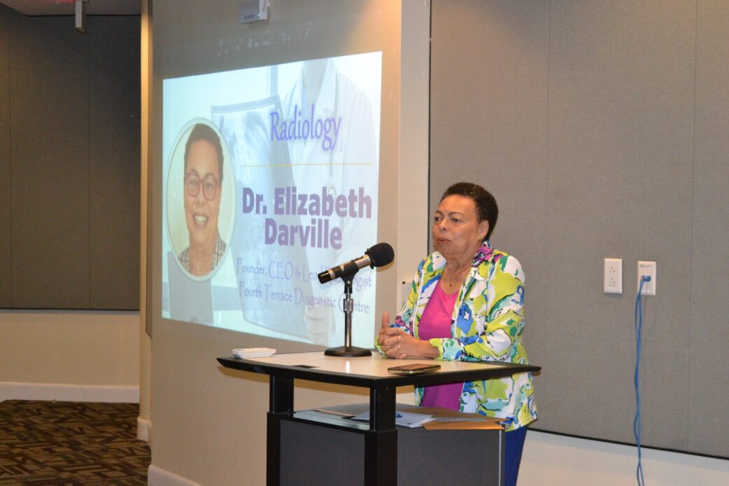
Dr. Elizabeth Darville
“It is important to know enough about yourself in order to make the decisions you want to make,” said Dr. Darville. “You have to work on yourself first and know what you want to do. Radiology gives you a chance to have fun. It gives you a chance to mold your career closer to your personal life than other medical specialties might.”
Another growing field is project management which Mr. Hepburn called a life skill. He also urged a commitment to lifelong learning.
“Individuals that continue to learn become unstoppable, period,” said Mr. Hepburn. “It is so true. When you learn, you become unstoppable because nothing can stop you in your process of development.
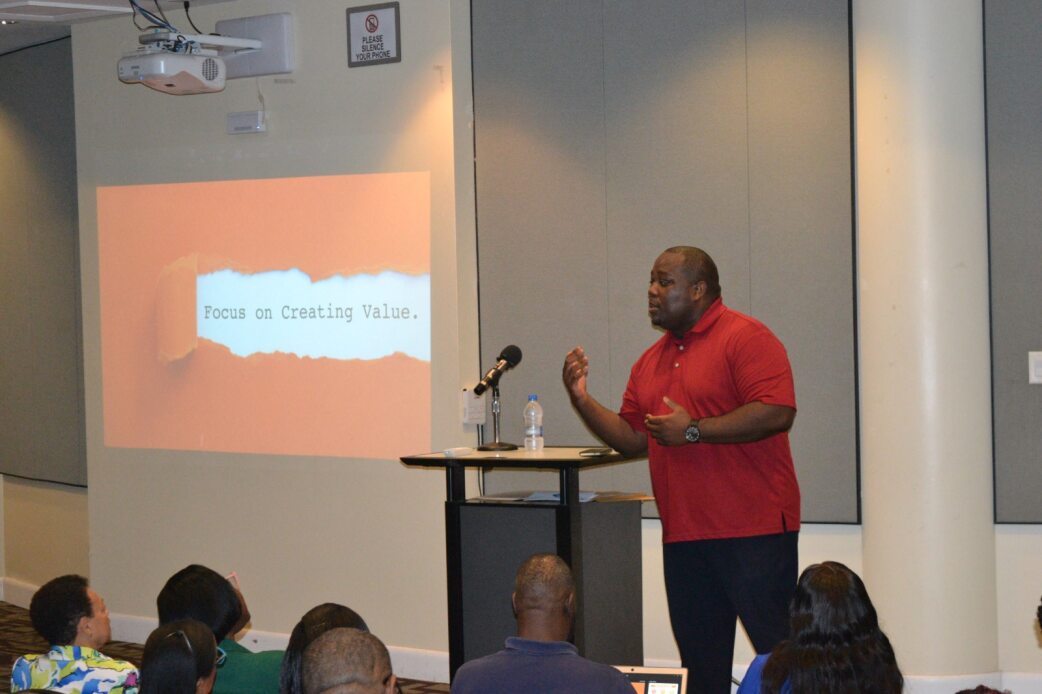
Mr. Wellington Hepburn
“The more you know, the more valuable you are. We need individuals who are cross functional—that can operate in different capacities. So please understand that your learning should never stop.”
With small and medium-sized businesses helping to drive the economy at an incredible rate, Ms. Rolle affirmed the importance of entrepreneurship in any economy.
“When we talk about entrepreneurship, we usually look at it from a myopic standpoint,” she said. Ms. Rolle. “What do I mean by that? Small, but usually about self: ‘how do I make more money?’ And in some cases, some look at entrepreneurship as a way of survival. ‘I need to make a couple extra dollars, I have this bill to pay’. Those types of things.
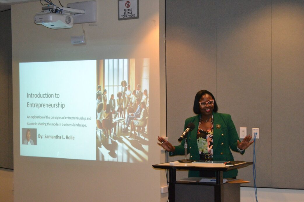
Ms. Samantha Rolle
“But entrepreneurship really, in its truest form, is about innovation, whether it’s a new concept or any existing concept that you innovate new ways, or help expand the economy.”
The career symposium was held at the Harry C. Moore Library and Information Centre and is held every academic year.
PHOTO CAPTIONS
- Career Symposium 1: UB Vice President of Academic Affairs, Dr. Maria Oriakhi, delivers the opening address at the 2024 Career Symposium.
- Career Symposium 2: Students and guest speakers enjoy a lighthearted moment during the 2024 Career Symposium.
- Career Symposium 3: Ms. Rickell Curry speaks to students during the 2024 Career Symposium.
- Career Symposium 4: Dr. Elizabeth Darville delivers remarks during the 2024 Career Symposium.
- Career Symposium 5: Mr. Wellington Hepburn educates students on the importance of project management during the 2024 Career Symposium.
- Career Symposium 6: Ms. Samantha Rolle talks about the role and importance of entrepreneurs and entrepreneurship in any economy.
Office of University Relations
University of The Bahamas
2nd Floor, Michael H. Eldon Complex
Oakes Field Campus
P.O. Box N-4912
Nassau, The Bahamas
Tel: (242) 302-4355/4354/4365
Rashaed Esson
Staff Writer
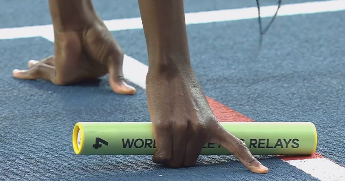
#TheBahamas, April 15, 2024 – After years of thorough maintenance, The Thomas A Robinson National Stadium in The Bahamas is finally getting a multi-million dollar makeover, readying the 10-year old facility ahead of the World Athletics Relays on May 5, 2024; it is being staged in Nassau for the fourth time.
This $36 million refurbishment is being funded by the Chinese Government, as part of a vision to enhance the country’s sport infrastructure to benefit youths in athletics. The stadium was gifted to The Bahamas in 2012 by the Chinese.
The relay is the qualifying event for the 2024 Summer Olympic Games and there will be 32 national teams, in each relay event, and 20 races on both days of competition, according to World Athletics.
Day 1, will have 20 heats across the five Olympic-calibre events (4 heats each for 4×100, 4×400, men, women and mixed) and will qualify 40 teams for the Summer Olympics.
Distinctly, the top two teams from each heat will directly qualify for the 2024 Games.
On day 2, 30 more national teams will be qualified through 15 heats and five finals, across those five events.
The upgrades which include new trusses, rooftops, seats, the lawn, score boards, LED displays and more, are expected to be complete at least two weeks before the relays, being held under the theme: ‘Chase the Sun’.
In a special ceremony on Monday April 8, The Bahamas Prime Minister, Philip Davis said:
In December 2023, our shared vision took shape, as the government of the Commonwealth of The Bahamas, and the government of the People’s Republic of China, inked an implementation agreement for the renovation of the stadium. This gesture of goodwill and friendship, from the Chinese government to undertake the China Aid Maintenance and Renovation project of our national stadium, stands as a testament to the strong bonds that unite our countries. This project, executed by China Urban Construction Research Institute Company Limited, and the China Machinery Industry Construction Group Company Limited, reflects our shared commitment to excellence, innovation and mutual development.”
Additionally, H.E Dai Qingli, outgoing Chinese Ambassador to The Bahamas who also attended that ceremony, spoke.
“At the end of the project, the Bahamian people will get a fully renewed and modern world class stadium because everything is going to be either renewed or repaired,” she said.
Some 1,600 athletes will be in The Bahamas for the World Athletics relays, with five events. The Bahamas won the bid over Lausanne, Rome in 2022.
Mario Bowleg, Minister of Youth, Sports and Culture in reports, thanked China for their contribution to the redevelopment of the stadium.
“We thank them for their commitment to ensuring that they bring this facility back up to A1 standard so that we can continue holding international events and using these facilities as a development of our young people.”
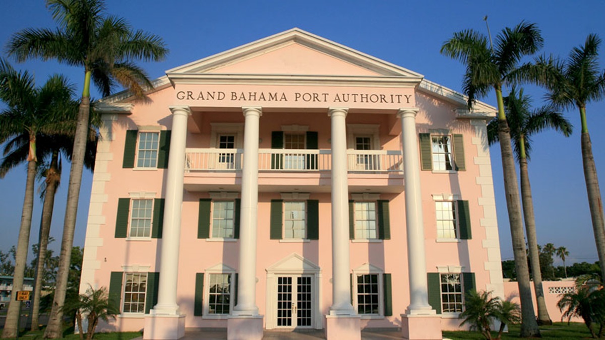
#TheBahamas, April 15, 2024 – The Bahamas Government says the Grand Bahama Port Authority owes over $300 million, now causing a very public squabble between the two entities and potential years long arbitration proceedings.
The total owed according to the government is $357 million over the last five fiscal years, 2018-2022.
Seemingly down to business, the Davis Administration, according to reports, sent a letter to the Port Authority at the start of the month, in which 30 days was given for them to pay up.
If the 30-day deadline isn’t met, Davis says the Government has the right to start arbitration proceedings.
A Grand Bahama attorney who criticized the government’s actions, also expressed that the tension could lead to up to five years of arbitration.
The letter, as reported by the Tribune, refers to clause 1(5)(c) of the Hawksbill Creek Agreement.
Regarding the tensions between the Port Authority and the Government, the financial conflict apparently rests on Davis’ accusation that the Port Authority failed to follow its obligations under the Hawksbill Creek Agreement.
“Unfortunately, the Port Authority has not been living up to its legal obligations to develop and grow the economy in Freeport. In many cases, the government has had to step in where the Port has failed. Let’s be clear about what this means: it means that the Bahamian people have been subsidizing the profits of these private shareholders! That is not right. You deserve flourishing, thriving communities. You deserve an inclusive economy that generates opportunity, dignity, and security. You deserve what is owed to you under the Hawksbill Creek Agreement,” Davis said.
In a clap back at the Government’s accusations, the Port Authority in reports are quoted declining the Government’s claim that they owe the “sum of $357 million.”
“We reject and will robustly defend against this claim, which we firmly believe will be defeated,” it stated.
Davis, who was speaking in a meeting on Saturday April 6, informed that before things got to this level, they were having meetings.
“We had many, many meetings and exchanges before we arrived at this point. But there were too many delays and too many dead ends. When only one side appears interested in advancement – and when the people of Freeport urgently need change and progress – then decisive action is the only choice,” he maintained.
The now peaked tension was sparked in June of 2023 when Davis stated that the Authority is failing to maintain Freeport’s infrastructure and encourage the growth of the city, as it claimed owed expenses, now said to be the hundreds of millions.
To this, in June 2023, the free quasi-governmental authority responded saying the sums stated by the government are “contested” and “it is yet to be satisfied,” claims reports say, are supported by credible evidence.


-

 Caribbean News1 week ago
Barbados welcomes new aircraft
-
 Crime1 week ago
Males Charged with Firearm Offences
-
 Caribbean News1 week ago
Haiti political update and Trinidad and Tobago not sending troops for mission
-
 Health1 week ago
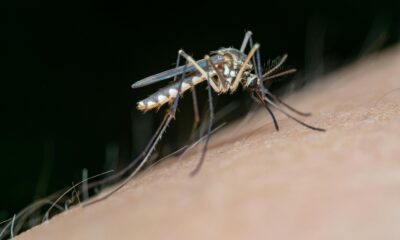
Dengue passes 1000 deaths mark in Brazil
-
 Health1 week ago
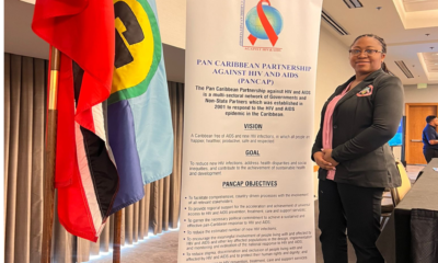
TURKS AND CAICOS ISLANDS PARTICIPATED IN EIGHTH MEETING OF NATIONAL HIV/AIDS PROGRAMME MANAGERS AND PANCAP SHARE FAIR
-

 Caribbean News4 days ago
Haiti Gang Firearms more than Police – UN says where they come from.
-

 Health1 week ago
Children and Teens Vaping, Royal TCI Police say “IT IS NOT SAFE!”
-

 Caribbean News4 days ago
Guyana Wildfires